
Rainy weekend increases flood risk
CENTRAL ONTARIO — A wet weekend with 50 to 75 mm of rain ahead brings with it a caution from provincial water management officials.
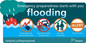
The Ministry of Natural Resources and Forestry – Parry Sound District is advising area residents that a “Watershed Conditions Statement – Water Safety” is in effect for Central Ontaio.
That means high flows, melting ice or other factors could be dangerous for such users as boaters, anglers and swimmers in the Muskoka, Parry Sound and a north-west portion of the County of Haliburton area.
But no major flooding is expected.
The official advisory is in effect until April 20.
The MNRF says residents within the Parry Sound-Muskoka area should keep a close watch on conditions, regularly check for updated messages and exercise caution around water bodies as flows and levels within rivers and streams are anticipated to rise in the coming days.
Although flooding is not expected at this time, residents may wish to consider taking action to secure or protect any property in flood-prone or vulnerable areas.
It is expected that lower-lying portions of known flood-prone roads along river courses will be impacted to various degrees as river levels remain start to increase over the next week.
With cooler temperatures, banks and shorelines adjacent to water bodies are extremely slippery and unstable. Residents and visitors should exercise caution while around water bodies and maintain close supervision of children and pets.
Travelling on the newly formed ice should be avoided.
MNRF also advises extreme caution when using forest access roads for outdoor activities as many are seasonally inundated with water, prone to washouts and may be impassible due to current water levels.
MNRF is closely monitoring the weather and developing watershed conditions. Further updates will be issued as appropriate.
After a brief respite late Thursday and overnight into Friday, southern Ontario will see a slow moving “Colorado Low” system move into the region later on Friday.
This system will bring rain for southwestern Ontario, and mixed precipitation consisting of rain, freezing rain, and ice pellets through the Bruce Peninsula, Muskoka and Algonquin Park.
They say 15-20 mm of rain could be expected in the Grey –Bruce region. Lesser amounts of accumulation are expected for the remainder of southern Ontario later on Friday and overnight.
On Saturday, the warm front associated with the “Colorado Low” is expected to slide southwards, concentrating the continuing rain in a heavy band in southwestern Ontario, where 20-30 mm could fall.
East of Toronto, and south of Highway 7, 10-15 mm of rain is expected, while areas further northwards to the French River and Lake Nipissing can expect snow and ice pellets.
Sunday will see the center of the “Colorado Low” move into southern Lake Huron.
Significant periods of rain for much of southern Ontario can be expected, while through the Muskoka, Haliburton, Algonquin Park regions and northwards to Sudbury – North Bay – Mattawa, the precipitation is expected to fall as freezing rain, ice pellets and snow in the northern sections. 20-35 mm of water equivalency is expected through the day on Sunday.
Over the five-day forecast period, total accumulations in south central and eastern Ontario could expect 50-75 mm.
The system will continue to impact southern Ontario into Monday and possibly Tuesday, and the track and intensity of storm systems may change through the forecast period.
TECHNICAL INFORMATION
Description of Weather System:
This message is being sent based on information received from MNRF – Surface Water Monitoring Centre, MNRF – Aviation Forest Fire and Emergency Management Services and Environment Canada.
A relatively fast moving “Alberta Clipper” will pass through southern Ontario, warming temperatures up to seasonal values (+5 to +10 C) and delivering 10 -20 mm of rain as the system passes, and bringing strong south westerly winds.
Description of Current Conditions:
Current water levels and flows are normal for this time of year, but are anticipated to rise due to warm temperatures, rain and rapid snow melt. Current snow conditions in the Muskoka and Parry Sound are slightly above average for this time of year. The area is blanketed with an average of 32cm of snow depth containing 114mm of snow water content.
Snowmelt and runoff due to forecasted warm temperatures and precipitation will result flows and levels rising depending on current stream condition locally. Combined runoff from the rainfall and snowmelt might result in high water levels and localised flooding in low lying areas. Residents should be cautions as ice conditions on lakes and rivers may change rapidly as a result of rising flows and water levels.
Daytime highs are forecasted to continue to be above average for the remainder of the week and into with daytime highs ranging from -2 to 6°C. Overnight lows are forecasted to stay below freezing ranging from 1°C to -5°C for the remainder of February.
This message will expire on Friday, April 20 2018, noon.
Terminology: Notification Levels:
WATERSHED CONDITIONS STATEMENT – WATER SAFETY: indicates that high flows, melting ice or other factors could be dangerous for such users as boaters, anglers and swimmers but flooding is not expected.
WATERSHED CONDITIONS STATEMENT – FLOOD OUTLOOK: gives early notice of the potential for flooding based on weather forecasts calling for heavy rain, snow melt, high winds or other conditions
FLOOD WATCH: potential for flooding exists within specific watercourses and municipalities
FLOOD WARNING: flooding is imminent or occurring within specific watercourses and municipalities.
Contact Information:
For more information please contact the Parry Sound District MNRF Water Management Department by calling 705-646-5531 or by email at watermanagement.psdistrict@ontario.ca
A close watch on local conditions and weather forecasts from Environment Canada is recommended. Environment Canada bulletins can be found at http://weather.gc.ca/
The Surface Water Monitoring Centre public webpage can be found here: http://www.ontario.ca/flooding