
EXPECT RAIN, MAYBE FLOODING EASTER WEEKEND
Mark Clairmont | MuskokaTODAY.com
CENTRAL ONTARIO — Heavy rain today totalling up to 50 mm by late Friday has weather-watching officials urging caution around any water bodies.
Environment Canada and Ontario’s Ministry of Natural Resources and Foresty (MNRF) both advise localized flooding in low-lying areas is possible.
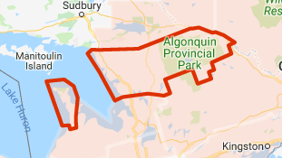
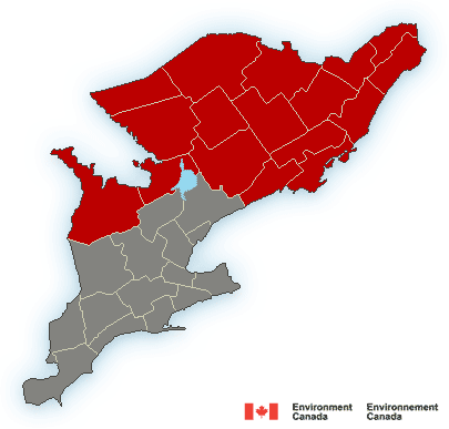
Environment Canada and has issued a warning across much of Central Ontario, from Gravenhurst and Bracebridge to Huntsville, and from Port Severnand Parry Sound across to Baysville, up through Huntsville, Alonquin Park and north to South River, Deep River and Burk’s Falls among several area communities.
Existing frozen ground has a reduced ability to absorb this rainfall.
Significant rainfall on tap may fall heavily at times, and will likely mean significant breaks in the precipitation from time to time.
Some wet snow may mix in with the rain Friday over some areas as temperatures will likely be near or just above the zero degree mark.
The precipitation is the result of a very slow moving trough of low pressure.
To report severe weather, email ONstorm@canada.ca or tweet reports using #ONStorm.
 Meanwhile, the Ministry of Natural Resources and Forestry – Parry Sound District is advising area residents that a Flood Watch is in effect in the District, which includes the District Municipality of Muskoka, the Territorial District of Parry Sound and a north-west portion of the County of Haliburton, until Wednesday, April 24.
A MNRF release Wednesday said: “Current water levels and flows continue to rise with the warmer weather we have received over the last week.
“Snow remains throughout the district with snow depths ranging from 22-54cm and snow water content ranging from 87-189mm.”
They say lake and river levels are expected to increase significantly due to runoff from the forecasted precipitation and from expected snow melt over the weekend and into next week.
“Residents affected by high water conditions in the past should take necessary action to secure any vulnerable property in close proximity to rivers and lakes and closely monitor developing conditions.”
Daytime high temperatures are forecast in the 5 to 15 degree Celsius in the area. Night-time low temperatures are largely forecast to remain at or above 0 degrees Celsius in the area.
Mid-April snow surveys show a continuing snowpack ranging from 100 to 200 mm of snow water equivalent in central Ontario. These values are above average to well above average for this time of year.
The MNRF reminds residents within the Parry Sound-Muskoka area they should keep a close watch on conditions, regularly check for updated messages and exercise caution around water bodies as flows and levels within rivers and streams are anticipated to rise in the coming days.
Although flooding is not expected at this time, residents may wish to consider taking action to ensure their sump pumps are working properly and to secure or protect any property in flood-prone or vulnerable areas.
It is expected that lower-lying portions of known flood-prone roads along river courses will be impacted to various degrees as lake/river levels increase over the weekend and into next week.
Banks and shorelines adjacent to water bodies are extremely slippery and unstable. Residents and visitors should exercise caution while around water bodies and maintain close supervision of children and pets.
The ministry is closely monitoring the weather and developing watershed conditions. Further updates will be issued as appropriate.
TECHNICAL INFORMATION
Description of Weather System
A Colorado low merging with a Texas low is forecast to move in tonight (Wednesday evening) bringing significant precipitation, mostly in the form of rain, across the Province. The precipitation will begin Wednesday evening where 15 to 25 mm is forecast along the shores of the upper Great Lakes. The system is forecast to slide south on Thursday and drop 15 to 30 mm of rain across a large swath of central and southcentral Ontario. Rainfall is forecast to persist into Friday with 15 to 30 mm forecast across a large swath of southcentral, south and southeastern Ontario. 2
Thunderstorms associated with this event are possible and may produce and additional 5 to 10 mm in isolated areas.
Totals across a broad swath of south and central Ontario in the range of 30 to 50 mm are forecast over the next three days with higher amounts possible in isolated areas.
High winds associated with system in the range of 30 to 35 km/hr with stronger gusts up to 45 km/hr are forecast across the lower Great Lakes.
DEFINITIONS
- WATERSHED CONDITIONS STATEMENT – FLOOD OUTLOOK: gives early notice of the potential for flooding based on weather forecasts calling for heavy rain, snow melt, high winds or other conditions
- WATERSHED CONDITIONS STATEMENT – WATER SAFETY: indicates that high flows, melting ice or other factors could be dangerous for such users as boaters, anglers and swimmers but flooding is not expected.
- FLOOD WATCH: potential for flooding exists within specific watercourses and municipalities
- FLOOD WARNING: flooding is imminent or occurring within specific watercourses and municipalities.
LEARN MORE
- Surface Water Monitoring Centre public webpage www.ontario.ca/flooding
- Environment Canada bulletins: www. weather.gc.ca
- A close watch on local conditions and weather forecasts from Environment Canada is recommended.
Ontario.ca.mnrf
For more information call the ministry’s Parry Sound district water management department regional office in Bracebridge at 705-646-5531 or email them at watermanagement.psdistrict@ontario.ca