
Rains first week of school lead to ‘water safety’ alert from MNRF
PARRY SOUND-MUSKOKA — The end of summer, the start of fall and school brings about an early warning about water safety.
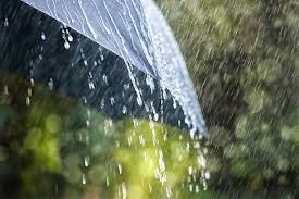
It may seem early — and a ironic given nearby forest fires — but the MNRF has issued a “water safety” alert for the Labour Day weekend.
It comes as a result of rain expected the first week of school.
And parents of children should pay particular attention.
Thundershowers are predicted Monday, Tuesday and Wednesday, and just showers Thursday, before a return to sun Friday and through next weekend.
Friday the Parry Sound District office of the Ministry of Natural Resources and Forestry Parry Sound District advise area residents that a Watershed Conditions Statement – Water Safety is in effect for the District of Muskoka, the Territorial District of Parry Sound and a north-west portion of the County of Haliburton.
It indicates that high flows or other factors could be dangerous for such users as boaters, anglers and swimmers — but flooding is not expected.
The release from the Bracebridge office, says residents within the Parry Sound-Muskoka area should keep a close watch on conditions, regularly check for updated messages and exercise caution around water bodies as flows and levels within rivers and streams continue to remain high as a result of recent rainfall. Although flooding is not expected at this time, residents may wish to consider taking action to secure or protect any property in flood-prone or vulnerable areas.
They say it is expected that lower-lying portions of known flood-prone roads along river courses may be impacted to various degrees as river levels remain high.
Residents and visitors should exercise caution while around water bodies and maintain close supervision of children and pets.
MNRF also advises extreme caution when using forest access roads for outdoor activities as many are seasonally inundated with water, prone to washouts and may be impassible due to current water conditions.
The ministry says it is closely monitoring the weather and developing watershed conditions. Further updates will be
issued as appropriate.
TECHNICAL INFORMATION:
Description of Weather System
This message is being sent based on information received from MNRF – Surface Water Monitoring Centre, MNRF – Aviation Forest Fire and Emergency Management Services and Environment Canada.
Multiple weather systems have passed through the area resulting in significant rainfall events. Accumulative rainfall over the last couple weeks has ranged from 90-200mm and the forecast indicates that more rain is expected over the next 7 days.
Description of Current Conditions
Current water levels and flows are higher than normal for this time of year, due to higher than normal precipitation amounts.
Recent, widespread and heavy rainfall received across the region resulted in higher than normal flows and this is expected to continue over the next week as more rain is received in the area.
Expiry Date:
This message will expire on Friday, September 07 2018, 12:00 AM
Terminology: Notification Levels
WATERSHED CONDITIONS STATEMENT – WATER SAFETY: indicates that high flows, melting ice or
other factors could be dangerous for such users as boaters, anglers and swimmers but flooding is not
expected.
WATERSHED CONDITIONS STATEMENT – FLOOD OUTLOOK: gives early notice of the potential for
flooding based on weather forecasts calling for heavy rain, snow melt, high winds or other conditions
FLOOD WATCH: potential for flooding exists within specific watercourses and municipalities
FLOOD WARNING: flooding is imminent or occurring within specific watercourses and municipalities.
For more information please contact:
Parry Sound District MNRF Water Management Department
Call 705-646-5531 or by email at watermanagement.psdistrict@ontario.ca
A close watch on local conditions and weather forecasts from Environment Canada is recommended.
Environment Canada bulletins can be found at http://weather.gc.ca/
The Surface Water Monitoring Centre public webpage can be found here: http://www.ontario.ca/flooding